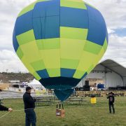
Pilots and Balloons
The Balloonist’s Prayer
The winds have welcomed you with softness.
The sun has blessed you with his warm hands.
You have flown so high and so well
that God joined you in laughter
and set you gently back into
the loving arms of Mother Earth.

The talented pilots of The Great Reno Balloon Race use wind currents and elevation to control the direction they travel. As pilots ascend or descend into a sea of wind currents that exist in the atmosphere, the balloon takes on different directions. Each morning, pilots are briefed about wind speeds and directions at various “ceilings” or elevation measurements. The pilots use this information along with the forecasted weather changes and the local terrain as navigational tools. When it comes to ballooning, there is much more than meets the eye!
GRBR COMPETITION
This year, The Great Reno Balloon Race will be back to a full three days of competition ballooning (weather permitting). This year will include the finale for the three-event Nevada State Hot Air Balloon Championship where Nevada State pilots will be vying for the state title. Besides the standard targets on the ground, this year’s competition will include virtual targets in the sky. Competitors will have to use electronic devices to navigate these aerial tasks where they will drop an electronic mark on the invisible target.
2025 Special Shape Round-Up
2025 Pilots & Balloons
2025 RC Pilots & Balloons
FILMING IN PROGRESS
Please be advised that The Great Reno Balloon Race is photographing, filming and/or recording at this location. By entering this location, you consent to being photographed and/or recorded and you grant The Great Reno Balloon Race and its marketing agencies/partners and licensees the right to use the photographs and recordings of your image and/or voice for marketing, promotional or publication purposes. You hereby release and discharge The Great Reno Balloon Race from any and all claims of copyright, libel, slander, violation of privacy or similar right you may have.
IN CASE OF AN EMERGENCY
Washoe County Emergency Management has established a map with critical information that is updated throughout the time of emergency. You will be able to find elements such as road closures, evacuation areas, evacuation routes, and a reunification center on the map. This map can be found at https://experience.arcgis.com/experience/46cb79ef933d4485b9966a9730e2d944/page/Perimeter/


